Flooded house south of Dhaka, Bangladesh (23°21’ N, 90°31’ E).
Bangladesh is a delta plain covered by a vast network of three hundred waterways. From June to September, heavy monsoon rains cause the rivers to overflow their banks and flood nearly half of the country. Accustomed to this natural cycle, part of the country’s population lives permanently on chars, ephemeral river islands made of sand and silt deposited by the rivers. In 1998, however, two-thirds of the country remained under water for several months following the worst flood of the 20th century, which claimed 1,300 lives and left 31 million Bangladeshis homeless. Because of global warming, natural disasters of this kind are becoming increasingly common, and six years later Bangladesh was once again hit by devastating floods. It is one of the most heavily populated countries on Earth, and also one of the poorest and the most vulnerable to climate change. Before 2020, 20 million Bangladeshis may be forced to leave their country because of the gradual disappearance of their land under rising waters, , according to the Intergovernmental Panel on Climate Change (IPCC). The United Nations estimates that in 2050 some 200 to 250 million people could be “climate refugeesâ€, people forced to relocate due to global warming related environmental disasters.

Pirogue near Dhaka, Bangladesh

Market near Dhaka, Bangladesh

Farmers transplanting rice in the riverbed of the Brahmaputra River, near Gaibanda, Bangladesh (25°15’ N, 89°39’ E)
Shared by Bangladesh and India, the vast swampy plains of the Bengal Delta (35,907 square miles or 93,000 square kilometers) were build up by the enormous volumes of alluvial deposits transported from the Himalaya Mountains by three large rivers –the Ganges, the Brahmaputra and the Meghna– and by a network of diverting channels and secondary rivers. About five million Bangladeshis live on the « chars », short-lived alluvial islands formed by the accumulation of sand and silt. On these islands, the inhabitants grows rice, the staple food of the Bangladeshi diet. In spite of the natural fertility of the muddy soil, the yield remain low because of climatic uncertainties. Indeed, during the summer monsoon rains, from June till September, more than 20 percent of the delta of Bangladesh is regularly flooded, and much more when the same year when a exceptionnal monsoon floods are followed by cyclone. In November 2007, tens of thousands of houses were destroyed by the cyclone Sidr and two major floods have caused the loss of 1,4 million short tons of rice. This is why the country financed the development of three new varieties of rice which whitstand a prolonged flooding. These new varieties will be cultivated for the first time in 2010. When a char is submerged, their inhabitants find refuge on the river banks and nearby islands while waiting for a drop of the water level. But it happens that the char is completely eroded. It is then necessary to wait months, even years, before seeing it reappearing in the riverbed. The average life of char is so from 10 to 25 years. According to the Intergovernmental Panel on Climate Change (IPCC), the rise of the sea level could gobble up 17 percent of the total surface of Bangladesh before 2050, making at least 20 million people homeless.

Flooded village south of Dhaka, Bangladesh (23°43’ N, 90°25’ E).
Bangladesh lies in the immense delta of the Ganges and Brahmaputra rivers, and half of the country is flooded by the monsoon each year. Yet for drinking water, Bangladesh’s 135 million people need to look underground. During the 1970s, international organizations such as UNICEF funded the drilling of thousands of wells that were supposed to provide “healthy†water for the population. But these operations led instead to what the World Health Organization has described as the “largest mass poisoning of a population in history.†More than a quarter of the wells have been contaminated by high levels of arsenic, up to seventy times the national standard for drinking water. Planners never tested for arsenic, which has occurred naturally in the delta’s alluvial deposits for millennia, before drilling the wells. This “natural†pollution is thought to have exposed 75 million people to poisoning that can lead to breast cancer, kidney and liver diseases, respiratory problems, and death. United Nations researchers have forecast 20,000 deaths per year.

Flooded houses south of Dhaka, Bangladesh (23°21’ N, 90°31’ E).
Bangladesh is a delta plain covered by a vast network of three hundred waterways. From June to September, heavy monsoon rains cause the rivers to overflow their banks and flood nearly half of the country. Accustomed to this natural cycle, part of the country’s population lives permanently on chars, ephemeral river islands made of sand and silt deposited by the rivers. In 1998, however, two-thirds of the country remained under water for several months following the worst flood of the 20th century, which claimed 1,300 lives and left 31 million Bangladeshis homeless. Because of global warming, natural disasters of this kind are becoming increasingly common, and six years later Bangladesh was once again hit by devastating floods. It is one of the most heavily populated countries on Earth, and also one of the poorest and the most vulnerable to climate change. Before 2020, 20 million Bangladeshis may be forced to leave their country because of the gradual disappearance of their land under rising waters, , according to the Intergovernmental Panel on Climate Change (IPCC). The United Nations estimates that in 2050 some 200 to 250 million people could be “climate refugeesâ€, people forced to relocate due to global warming related environmental disasters.

Flooded houses south of Dhaka, Bangladesh (23°41’ N, 90°25’ E).
Bangladesh is a delta plain covered by a vast network of three hundred waterways. From June to September, heavy monsoon rains cause the rivers to overflow their banks and flood nearly half of the country. Accustomed to this natural cycle, part of the country’s population lives permanently on chars, ephemeral river islands made of sand and silt deposited by the rivers. In 1998, however, two-thirds of the country remained under water for several months following the worst flood of the 20th century, which claimed 1,300 lives and left 31 million Bangladeshis homeless. Because of global warming, natural disasters of this kind are becoming increasingly common, and six years later Bangladesh was once again hit by devastating floods. It is one of the most heavily populated countries on Earth, and also one of the poorest and the most vulnerable to climate change. Before 2020, 20 million Bangladeshis may be forced to leave their country because of the gradual disappearance of their land under rising waters, , according to the Intergovernmental Panel on Climate Change (IPCC). The United Nations estimates that in 2050 some 200 to 250 million people could be “climate refugeesâ€, people forced to relocate due to global warming related environmental disasters.

Chittagong ship breaking yard, Chittagong, Bangladesh

Village on the banks of the Brahmaputra river, near Gaibandha, Bangladesh

Transport of cows on the Brahmaputra river, near Gaibandha, Bangladesh

Hospital ship on the Brahmaputra river, near Gaibandha, Bangladesh

Pirogue on the river Jamuna (Brahmaputra) near Gaibandha, Bangladesh (25°15’ N, 89°39’ E).
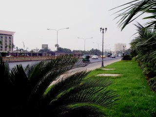
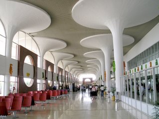
Bangladesh is a deltaic plain drained by some 300 rivers, which for the most part, represent essential waterways. Swollen by the melting of Himalayan glaciers and above all by the summer monsoon, the Ganges and Brahmaputra rivers overflow their banks and flood nearly half of the country. In this small territory of 143,000 km2, where 156 million people live, the population has adapted to these constraints. The rivers are as much dreaded as indispensable for water supplies to cities and the countryside, for transportation of people and freight, for the fertility and the protection of land from ocean and hurricanes. Millions of men and women are living on river islands that the flow of rivers and floods redraw constantly. But Bangladeshis must today face the increased danger and frequency of extreme weather caused by climate warming.

Farmer ploughing his field near Dhaka, Bangladesh

Brick-makers near Dhaka, Bangladesh

Fishing nets in the area of Dhaka, Bangladesh (23°43’ N, 90°20’ E).
Bangladesh is well endowed with rivers, lakes, ponds, estuaries and natural depressions which are suitable for fishing and especially aquaculture, in serious development nowadays. It’s the 6th largest aquaculture producing country of in the world. The fish catch from mainland fishing are almost four times higher than catches at sea in the Gulf of Bengal. Approximately 12 million people are working in the fishing sector, mainly subsistence fishing and often seasonal. Traditional fishing accounted for about 56% of the total fish production in 2004. Bangladeshis replace the consumption of red meat, too rare and expensive, by the fish. Each year, an inhabitant consumes 14kg of fish, an insufficient quantity according to FAO, which recommends a minimum consumption of 18 kg per year per capita.

Pump in a paddy field near Dhaka, Dhaka Region, Bangladesh (23°54’ N, 90°20’ E).
In Bangladesh, rice is sown by hand in fields where the water level rises quickly at the beginning of the monsoon. To fight against climatic hazards (drought, flood) associated with rice growing in wetland or in deep water, pumps are installed to permit an irrigated culture that ensures a steady and higher yield. This allows a second and third harvest. But still, the energy, whether petrol for the most part, or electricity (one Bangladeshi in two is not connected to the electricity grid) is expensive for farmers in a country where 40% of the population live below the poverty line. An estimated 1.3 million of all kinds of pumps are used in the country, the government subsidizing the purchase of this equipment. Each year, diesel pumps consume around 800 million litres of fuel which is imported and whose price, also subsidized, is subject to market fluctuations. Recently, the government has begun to promote solar pumps with electric motor powered by photovoltaic panels.

Brickyards near Dhaka, Bangladesh

Floating wood near Dakha, Bangladesh

Sand extraction from the Buriganga river in Dhaka, Bangladesh

Source: Yann Arthus-Bertrand